
Cross-Sector Collaboration Key to Harness Earth Intelligence for Sustainable Rice Cultivation
04 November 2025, Thailand: The 17th AOGEO Symposium was held to explore how the Asia–Oceania region can turn Earth Observation (EO) data into actionable Earth Intelligence for regional challenges. This event was jointly organized by the Geo-Informatics and Space Technology Development Agency (GISTDA) of Thailand and the Ministry of Education, Culture, Sports, Science and Technology-Japan (MEXT), with support from the GEO Secretariat.
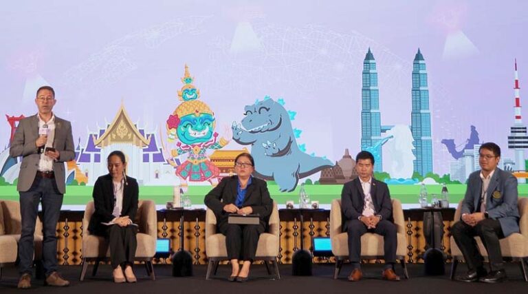
“Earth Intelligence for Food Security: Sustainable Management of Rice Ecosystems,” opened the symposium’s discussions. This session was moderated by Dr. Bjoern Ole Sander, Senior Scientist and Country Representative of the International Rice Research Institute (IRRI) in Thailand, who guided the exchange on EO-enabled water management, sustainable rice cultivation and credible greenhouse gas (GHG) monitoring. Panelists were Mrs. Wimolpat Bumbudsanpharoke Khamkanya, Senior Expert in Economic Analysis for Water Projects at the Office of the National Water Resources (ONWR); Ms. Amornrat Intrman, Director of the Thailand Rice Science Institute, Rice Department; Mr. Panu Nueangjumnong, Acting Head of the Agricultural Management Division at GISTDA; and Dr. Parkin Maskulrath, Lecturer in Environmental Science at Kasetsart University.
The panel set out concrete national and technical contexts to enable the creation of Earth Intelligence. ONWR outlined Thailand’s 20-year water plan—implemented since 2018—covering domestic water access, water security, flood management and conservation, alongside improving rainfall forecasting to inform irrigation planning and farm preparedness. The Rice Department described research that links rice cultivars to geographic and meteorological suitability and its promotion of sustainable water practices such as Alternate Wetting and Drying, supported by smart water-level tools and remote sensing in collaboration with GISTDA. GISTDA detailed satellite-based services for crop classification, crop health monitoring, yield prediction and methane estimation. These services are complemented by mobile applications that enable farmers to report field conditions and improve ground truth as in verified, factual data. Kasetsart University presented research on methane generation in rice systems, noting that longer inundation and heavier rainfall typically raise methane emissions, while drier conditions reduce emissions unless fields are deliberately kept flooded.
The exchange among the panelists confronted persistent data hurdles when going from Earth Observation data to Earth Intelligence data. Participants emphasized that obtaining data at the spatial and temporal resolutions required for timely decisions remains difficult, that agricultural datasets are often fragmented, and that country-wide integration is needed to ensure comparability and usability across systems. Accuracy, validation and timeliness continue to be challenging to deliver at scale. Weather can also impede data collection: heavy rainfall and persistent cloud cover interrupt optical satellite sensing, while storms limit safe field access, damage sensors, and disrupt power and connectivity, all of which create gaps or delays in both remote and in-situ observations. Although some radar satellites can see through clouds, logistical and safety constraints during severe weather still hinder ground validation and rapid response.
The discussion repeatedly returned to practice change on the ground. Speakers believed that farmer engagement is most effective when framed in terms of direct value—profitability and cost savings from better water control, reduced pumping, and fewer inputs—rather than abstract climate benefits. They called for better communication between research, policy, and operations so that university and think-tank findings translate into actionable guidance for agencies and farmers. Communication was indeed highlighted as a critical enabler: satellite-derived insights, flood warnings, and agronomic advice should be conveyed in plain, non-technical language that supports immediate decisions at farm, agency, and policy levels. Finally, panelists urged institutions to break down data silos, recognizing the interdependence of each stakeholder’s work from policy level to paddy-field practice.
Looking ahead, the session’s recommendations on integrated data systems, user-first communication, farmer-aligned incentives, and cross-sector collaboration will inform the AOGEO Statement and strengthen regional contributions to GEO’s Post-2025 Strategy. IRRI will continue to collaborate with national agencies and partners to advance EO-enabled water management, adoption of practices such as Alternate Wetting and Drying, and robust methane MRV so that Earth Intelligence becomes routine decision support.
Outcomes from the event will be compiled into an AOGEO Statement for the AOGEO Caucus Principals and shared with the global GEO community, with the aim of advancing implementation of the GEO Post-2025 Strategy.
AOGEO is a Regional Group on Earth Observations (Regional GEO) which envisions a future where decisions and actions for the benefit of humankind are informed by coordinated, comprehensive and sustained Earth observations. The AOGEO Symposium is the annual regional forum for the Asia-Oceania GEO that facilitates the exchange of diverse perspectives and identification of emerging regional topics, fostering enhanced collaboration among various stakeholders.
Also Read: India Enforces 30% Import Duty on Canadian Yellow Peas, Impacting Global Pulse Trade
📢 If You’re in Agriculture, Make Sure the Right People Hear Your Story.
From product launches to strategic announcements, Global Agriculture offers unmatched visibility across international agri-business markets. Connect with us at pr@global-agriculture.com to explore editorial and advertising opportunities that reach the right audience, worldwide.


