Understanding How Artificial Intelligence Actually Functions in Farming Systems
Guest Author: Somesh Utkar, Omdena, focusing on applied AI projects in agriculture.
21 February 2026, London: In many farming systems, crop problems are discovered only after they become difficult to manage. Pests, diseases, and crop stress usually develop gradually, but detection still relies heavily on visual inspection and periodic field visits. By the time symptoms are clearly visible across a field, yield loss is often already underway.
This delay is not a result of poor decision-making or lack of experience. It reflects the reality that large fields are hard to monitor continuously and that early signs of stress are often subtle. Traditional scouting is time-consuming, access is uneven, and visual cues alone do not always reveal what is happening beneath the surface of the crop or soil.
In recent years, artificial intelligence has been explored as a way to support earlier detection. By analysing satellite imagery, drone data, and field-level images, AI systems aim to identify changes in crop behaviour before damage becomes obvious. The goal is not to replace farmers or agronomists, but to support earlier awareness and better prioritisation.
Insights from applied agriculture projects carried out through Omdena show that this approach can work when applied carefully. Each technology plays a different role, and results depend less on model sophistication than on how these tools are used in practice. Understanding where each approach adds value and where it falls short is critical for anyone applying AI in real farming environments.
Satellite Imagery for Early Detection of Crop Stress
Satellite imagery is often the first place AI is applied in agriculture because it offers scale. Large areas can be monitored regularly without requiring people on the ground, which is especially valuable in regions where farms are spread out or access is limited. Over time, satellites capture how crops develop across the season, making it possible to notice when growth patterns begin to diverge from what is expected.
This type of monitoring works best when it is used to track how crops change over the season. Crops under stress rarely show obvious signs in a single satellite image. Early stress tends to emerge gradually, as crop growth begins to deviate from what is expected at that stage of development. By comparing these patterns across repeated satellite images collected over time, AI models can flag areas where crop development is starting to drift from normal seasonal behaviour and may need closer attention.
This approach was applied in a project focused on armyworm damage assessment in maize-growing regions of Sub-Saharan Africa. The challenge faced by local stakeholders was not identifying the pest itself, but responding quickly enough to limit damage. Armyworm outbreaks spread rapidly, while field-level reporting depended on manual scouting and delayed aggregation.
The project used multispectral satellite imagery together with crop calendars and land cover information to model expected maize growth behaviour across the season. Instead of attempting to detect armyworms directly, the system identified areas where vegetation behaviour deviated persistently from seasonal norms. These deviations appeared earlier than widespread field reports and helped narrow down zones where further investigation was needed. A detailed walkthrough of the full implementation, including data sources, processing steps and validation logic, is available in the Omdena case study titled “Satellite Imagery for Detecting and Assessing Armyworm Damage in Agriculture,” which can be found on the Omdena website.
At the same time, the limitations were clear. Similar stress patterns were observed during periods of water stress and nutrient deficiency. Satellite imagery alone could not explain the cause of the problem. As a result, satellite outputs were positioned as early warning signals rather than definitive diagnoses.
The value of this approach lies in timing. Partners were able to focus attention and plan responses earlier, even if confirmation still required field checks. The key learning was that satellite-based AI is most effective when it helps decide where to look first, not when it attempts to replace field-level understanding.
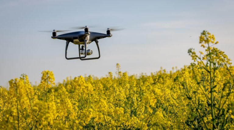
Drone Based Monitoring for Field Level Validation of Crop Stress
Once satellite imagery highlights areas of concern, the next question is usually practical. What is actually happening within the field? This is where drone-based monitoring becomes useful. Satellites provide coverage, but they do not offer enough detail to understand localised variation or early-stage stress within individual plots.
Drones help close this gap by capturing high-resolution imagery that reveals differences in plant vigour, canopy structure, and early stress patterns. When equipped with multispectral sensors, they can detect physiological changes that are not yet visible during routine field visits. This makes drones particularly valuable once an early signal has already been identified and needs closer examination.
In applied projects focused on crop health prediction and weed detection, drones were used as a follow-up layer rather than as a standalone system. Satellite data was first used to identify fields showing unusual behaviour over time. Drone flights were then planned selectively over those fields to collect more detailed data at key growth stages.
This approach helped clarify whether early signals represented temporary stress or emerging problems that required intervention. In some cases, drone analysis revealed localised issues related to soil variation or uneven irrigation. In others, early weed pressure or disease hotspots were identified before they spread across larger areas. This additional context made it easier for agronomists and farmers to decide where action was necessary and where it was not.
Operational constraints were also evident. Drone deployment depended on weather conditions, regulatory approvals, and trained operators. Processing and analysing high-resolution imagery required time and computing resources, and results varied across crops and seasons. These realities limited how frequently drones could be used and how easily systems could be scaled.
As a result, drones proved most valuable when used deliberately. They worked best as diagnostic and validation tools that strengthened earlier signals rather than as continuous monitoring solutions. The main learning was that drones add value when they answer specific questions raised by broader monitoring systems.
Computer Vision for Plant Level Disease and Weed Detection
Many farming decisions still depend on what is happening at the level of individual plants. Computer vision addresses this need by analysing images captured from smartphones, field cameras, or drone footage. It can support tasks such as identifying diseases, distinguishing crops from weeds, and documenting visible stress.
In theory, this is one of the most intuitive applications of AI in agriculture. Many crop health issues are already identified through visual inspection by farmers and agronomists, based on observable symptoms such as leaf discoloration, spotting, or abnormal growth. Computer vision builds on this existing practice by analysing images to make visual assessment faster and more consistent. Its effectiveness depends on factors such as lighting, image angle, crop growth stage, and how consistently images are captured in real field conditions.
This became clear in applied projects focused on plant disease classification and weed detection, including work on crop diseases in Brazilian agriculture and wheat leaf disease identification. The partners involved were seeking scalable ways to support diagnosis and reduce reliance on manual inspection.
Models trained on well-curated image datasets performed strongly in controlled testing. They were able to identify disease presence and separate crops from weeds with sufficient accuracy to support advisory use cases. These results showed clear potential for supporting earlier identification.
Field use introduced greater complexity. Images captured under real conditions varied widely in quality, lighting and framing. The same disease appeared differently across regions and growth stages. In many cases, the model could detect that a disease was present but struggled to indicate severity or urgency.
These limitations shaped how the technology was ultimately positioned. Computer vision proved most effective as an assistive tool that supported scouting and documentation rather than as an autonomous decision system. When paired with an agronomic context and continuous validation, it reduced the chance that early signs were missed and improved consistency in observation.
Challenges in Data Quality, Validation, and Scaling AI for Agriculture
As satellite imagery, drones, and computer vision are combined, data quality and validation emerge as the most persistent challenges. Early detection systems depend on understanding what normal crop behaviour looks like before deviations can be identified. In agriculture, this baseline is difficult to define because it varies with seasons, weather patterns, soil conditions, and differences in crop and field management.
When these systems move beyond pilot settings, the limitations become clearer. Models that work well in small trials often struggle across larger regions or different seasons, where growing conditions vary significantly. Ground truth data needed for validation is difficult and costly to collect because it requires direct coordination with farmers and agronomists in the field. As a result, only some model-generated alerts about potential crop stress or risk areas can be confirmed, which slows learning and makes it harder to improve the systems over time.
Projects that acknowledge this uncertainty and communicate it clearly tend to maintain stronger trust with partners. Overconfident predictions undermine credibility when edge cases appear or when models encounter conditions they were not trained on. In these projects, transparency proves more valuable than marginal gains in accuracy.
As systems scale, every weakness is amplified. Successful teams respond by simplifying outputs, focusing on prioritisation rather than precision, and embedding feedback loops wherever possible. Early detection works best when it is designed as a decision support system that guides attention, not as an automated authority that replaces human judgment.
How Earlier Detection Shapes Intervention Decisions
The most meaningful impact across these projects was not the elimination of crop loss, but a shift in when and how decisions were made. Before AI tools were introduced, responses were often reactive and uniform. Fields were treated once damage was visible, frequently across entire areas because there was little confidence about where problems were starting.
When satellite monitoring highlighted risk earlier, teams could focus attention sooner. Drone verification helped determine whether stress was widespread or localised. Computer vision supported faster and more consistent scouting. Together, these tools enabled earlier and more targeted intervention.
In some cases, this meant acting sooner. In others, it meant choosing not to act when early stress proved temporary. Both outcomes reduced unnecessary input use and improved confidence in decisions.
Early detection created value only when outputs were integrated into workflows that farmers and advisors already trusted. Systems that stopped at visualisation rarely changed behaviour. Systems that translated signals into clear priorities and practical next steps did.
Conclusion
Applied project experience shows that AI can support earlier detection of pest pressure, disease onset, and crop stress when systems are designed for real agricultural conditions. Satellite imagery, drones, and computer vision each contribute something valuable, but none work well in isolation.
The core lesson is that early detection is not just a technical challenge. It is a design challenge. When AI is treated as a decision support infrastructure that helps people focus attention and act earlier, it becomes genuinely useful.
For practitioners, the opportunity lies in building layered approaches that improve timing and focus rather than chasing perfect predictions. When AI helps farmers and advisors look in the right place sooner, it supports better decisions and reduces avoidable loss. That is where its real value lies in farming today.
Also Read: FMC and the Two-Engine Dilemma: When the Present Devours the Future
Global Agriculture is an independent international media platform covering agri-business, policy, technology, and sustainability. For editorial collaborations, thought leadership, and strategic communications, write to pr@global-agriculture.com