New Insights Into Conditions That Raise Frost Risk
19 May 2026, AU: New tools and modelling will help better assess crop damage from frost and heat, with new insights into the role of surface versus air temperatures.
Satellite imaging and air temperature data are being harnessed to give growers more accurate information about frost risk in their region.
As an alert for potential crop damage, this will support management decisions to optimise crop profitability.
That’s the aim of a 4-year ‘Frost and heat management analytics’ (FAHMA) project, which is a joint investment by GRDC ($6.26 million) and CSIRO ($3.24 million).
Originally targeting both heat and frost, the research has zeroed in on frost as the issue that growers and agronomists say is of greater concern.
“There is not much growers can do about heat damage in season,” says project leader Dr Julianne Lilley. “It’s all about planning in advance, variety selection, the timing of sowing and flowering.”
She says the project had looked at how heat causes damage and used new information from lentil and chickpea experiments to guide decisions about when crops should flower to avoid that damage.
“But with frost, we are developing ‘next day’ tools that provide alerts on potential crop damage and management options. That might include reducing pest or disease treatments on affected crops, grazing the paddock or cutting the crop for hay as soon as possible to preserve quality and get the best possible price,” she says.
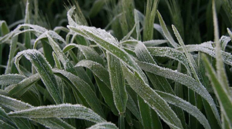
Surface temperature signals frost risk
Dr Randall Donohue’s work on the project has revealed new insights about the environmental conditions that signal the likelihood of frost. This has challenged the long-used rule of thumb that relies on air temperature as the key frost indicator.
“Frosts can occur when soil or canopy surface temperatures fall below 0° C and humidity is high enough for ice crystals to form,” Dr Donohue explains.
“On frosty nights, surface temperatures (of either soil or plants) are often lower than air temperature and a general rule has evolved that a frost will occur when air temperature is 2° C or less. However, we found this 2° C offset rule, based on air temperature, is not necessarily accurate.”
Dr Donohue says trials showed that the offset between air temperature and surface temperature was generally consistent at any given location, but it varied unpredictably between sites by as much as 7° C. Such variation in the offset could occur even when sites were only 250 m apart.
“We co-located thermal cameras and thermocouples to measure surface and air temperature, respectively, at 30 sites across the Australian winter cropping zone over the 2024 growing season. Our analysis focused on calm nights with clear skies.
Temperature variability
“Across the 30 sites, the surface temperatures could be as much as 4° C lower than air temperature, or as much as 3° C higher. Sites with higher-accuracy sensors generally recorded surface temperatures lower than air temperatures.”
Dr Donohue highlights physical factors that can influence the surface-air temperature offset, which makes predicting the offset difficult. These factors are:
- a site’s soil type and soil moisture content
- local topography
- canopy density and the canopy–sensor distance
- humidity, wind speed and the presence of mist or fog.
He says that to use the surface-air temperature offset as a reliable guide to frost risk, it needs to be established at each specific location, using the same air temperature sensor that will remain in place.
“Outside of this, air-temperature-derived frost information should be used with caution,” he warns. “It’s only about 85% accurate, so something to be aware of.
“Many growers will have frost risk for their properties calibrated in their heads, but it is so very site specific. They might know that when air temperature is 2° C, then down in the bottom paddock there’s no frost risk, but if it’s 1° C, then there is a risk. But for the grower across the road, these calibrations might be completely different.”
Dr Donohue says while on-farm weather stations will be more locally accurate than regional Bureau of Meteorology stations, few growers have thermal cameras to validate air temperature versus surface temperature.
Big data approach
That’s where new technology and data analysis being developed through the project comes in.
“We are moving into an era where surface temperature measurements can be made routinely using satellite-borne sensors.
“Canopy temperatures can be sensed directly, so there’s no need to assume a surface-air temperature offset.”
Dr Donohue says satellite-derived measurements, even at a coarse resolution, provide greater resolution than most land-based station networks.
And they provide them with consistent accuracy nationally (Figure 1).
“The next steps in this project are to use satellite-derived surface temperature measurements to detect sub-paddock-scale frost occurrence and to use that information to estimate grain yield loss,” he says.
“We’re collaborating with a few agtech companies in the project to develop prototypes and test which information is most valuable to growers and how best to deliver it.
“Importantly, the data will be broadly accessible, not restricted to just these companies, enabling different agtech companies to integrate it into their products for the benefit of agronomists and growers.”
The companies involved in prototype development include DataFarming (precision agriculture and digital tools), Pairtree (sensor integration platforms) and Hillridge (insurance technology).
Software tools for growers
During frost season, potential functions include a daily alert of high, medium, low or no frost risk for the previous night. Behind this, a deeper analysis using topographic and cold- air modelling, along with satellite images, can be provided to generate surface temperature maps at 30 m resolution.
This mapping can then be linked to crop growth information – what was planted and when, and the estimated drop in yield because of the previous night’s frost. Potential yield damage information has been garnered from previous GRDC investments in relevant research and incorporated into the Agricultural Production Systems sIMulator (APSIM).
Dr Lilley says the ability of APSIM to predict damage from extreme stress events, including frost, is a new function developed through the project. The damage function to assess yield loss in wheat and canola is well refined, with work continuing on barley.
Heat and frost damage information for lentils and chickpeas was also produced from field experiments during the project. Subject to further development, the information will be added to APSIM.
Growers can help us to validate our modelling if they are willing to share some of their data, such as yield maps, to help us correlate heat stress or frost stress with yield loss. We’d love to hear from anyone who would like to be involved.
Also Read: Insecticides (India) Limited Launches New Paddy Insecticide ‘Granuvia’
Global Agriculture is an independent international media platform covering agri-business, policy, technology, and sustainability. For editorial collaborations, thought leadership, and strategic communications, write to pr@global-agriculture.com