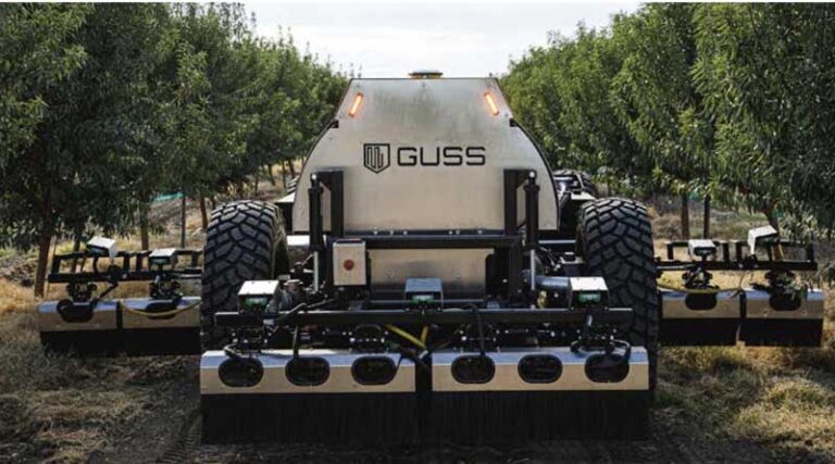
John Deere’s GUSS Robots Gain Color Lidar to Navigate Orchards Without GPS
07 October 2026, California: John Deere’s autonomous orchard-spraying unit, GUSS Automation, is fitting a new generation of color lidar sensors to its
Read More

Get the latest LiDAR Sensors news, research and developments covering laser-based sensing, three-dimensional mapping, precision agriculture, autonomous machinery and environmental monitoring. Light Detection and Ranging (LiDAR) sensors measure distances using reflected laser pulses to generate detailed spatial data about crops, trees, terrain and surrounding objects.
In agriculture, these sensors support crop-height measurement, canopy-volume estimation, biomass assessment, plant phenotyping, orchard mapping and soil-topography analysis. LiDAR systems mounted on drones, tractors, ground robots and other mobile platforms can generate 3D point clouds to help researchers assess crop structure, monitor growth and improve field management. Integration with cameras, GPS, inertial measurement units and machine-learning algorithms is expanding applications in precision spraying, crop monitoring and autonomous navigation.
Find updates on new sensor designs, agricultural robotics, digital farming, forestry applications and remote-sensing research. Recent studies are examining LiDAR-based orchard mapping, canopy characterisation, crop biomass estimation and obstacle detection for autonomous farm vehicles. Coverage also includes sensor accuracy, data processing, equipment costs and challenges such as vegetation occlusion and performance in rain, fog or dust, which influence the reliability of real-world applications.
07 October 2026, California: John Deere’s autonomous orchard-spraying unit, GUSS Automation, is fitting a new generation of color lidar sensors to its
Read More