Spatial Analytics across disciplines informs policymaking in Kenya: Dialogue between Alliance and KALRO
Chun Song, Elisabetta Gotor, Regina Nghete
21 May 2026, Kenya: On April 29, 2026, scientists from the Alliance of Bioversity International and CIAT met with experts from the Kenya Agricultural and Livestock Research Organization (KALRO) for a timely conversation on the topic of Spatial Analytics.
The two organizations have long-standing partnerships in areas such as beans research and climate-related work, but collaboration on spatial analytics (particularly approaches that integrate biophysical and socioeconomic dimensions to inform policy) remains an emerging frontier.
Why “Where” Matters More Than Ever
The discussion made one thing clear; agriculture is no longer just about what to do, but increasingly about where to do it.
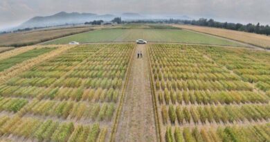
With climate variability, population growth, and other global trends, agricultural and livestock systems are under more pressure: greater demand for diverse and nutritious food, greater production resilience, and greater inclusiveness.
This pressure is not evenly distributed across space. Spatial analytics offers a way to navigate this complexity by revealing where policy interventions and investments are most needed, and where they are likely to have the greatest impact.
KALRO, Kenya’s leading agricultural research institution, is already deeply embedded in this work.
KALRO’s Expanding Use of Cutting-Edge Spatial Tools
During the meeting, Dr. David Golicha (Assistant Director, Department of Environment & Natural Resources, KALRO) highlighted how KALRO is leveraging spatial tools across its 16 research institutes. Their work spans:
- Digital soil mapping using machine learning
- Crop and pasture suitability mapping
- Land degradation hotspot identification for targeted restoration
- Geospatial integration of fertilizer trial data, directly informing Kenya’s national fertilizer subsidy programme
- Site-specific fertilizer recommendations, through the AABS model developed with partners
These efforts are closely aligned with national priorities, including Kenya’s Bottom-up Economic Transformation Agenda (BETA) and the country’s soil health action plan following the 2024 Nairobi summit.
Yet as advanced as these tools are, the demand for even more granular insights is growing.
Bridging Scales: From national to subnational
A central theme in the discussion was spatial resolution. Mr. Lucas Tanui (Geospatial Unit, Kenya Soil Survey, KALRO) raised a key concern: while county-level insights are valuable for planning and policy, KALRO increasingly needs local-level recommendations, for example, to guide precision fertilizer use.
This raises an important challenge: How can we connect broad socioeconomic models with fine-scale, site-specific data?
Dr. Chun Song (Spatial Econometrician, Alliance Bioversity-CIAT) acknowledged this gap and pointed to opportunities for more integration. While the Alliance’s work often operates at regional or national scales, such as projecting food demand or evaluating policy impacts, there is growing interest in linking these insights with biophysical and local level datasets.
What the Alliance Brings: Linking Data to Decisions
The Alliance’s spatial analytics work focuses on connecting data to policy-relevant questions. As presented by Dr. Chun Song, the team’s work includes:
- Future food demand downscaling, including work on the Nourishing Kenya Youth initiative by Regina Ngethe (Agricultural economist, Alliance of Bioversity and CIAT)
- Spatial impact evaluation
- Forward looking climate-conflict analysis across Africa
- Land use and agrobiodiversity modelling to understand future landscape changes
- A cross-CGIAR spatial synthesis, bringing together use cases from four CGIAR centers to demonstrate how spatial analytics can inform policy decisions.
- A Human-in-the-Loop (HITL) approach combining AI with expert judgment for policy analysis.
Emerging Areas of Collaboration
The meeting surfaced several promising areas for collaboration between KALRO and the Alliance:
- Pest and disease risk mapping, highlighted by Mr. Robert Opondo (Crop Protection & Pest Risk Analysis, KALRO)
- Integrated climate–economic–spatial modelling, emphasized by Mr. Reuben Ruttoh (Research Methods & Analytics, KALRO)
- Spatial impact evaluation of agricultural technologies
- AI applications for policy and research
These areas reflect a shared ambition: to move from static maps to dynamic, decision-support systems.
Looking Ahead
This meeting marked the beginning of a deeper partnership with spatial analytics. Both teams agreed to continue technical discussions and exchange knowledge, including sharing methodologies on food demand modelling, pest risk analysis, and AI-driven policy tools, with plans to identify concrete joint workstreams in the coming months.
What stands out is not just the overlap in expertise, but the complementarity. KALRO brings deep national knowledge and field-level modelling; the Alliance contributes interdisciplinary and regional experience.
Together, they are well-positioned to answer one of agriculture’s most critical questions: not just what works, but where action is needed most.
Also Read: Insecticides (India) Limited Launches New Paddy Insecticide ‘Granuvia’
Global Agriculture is an independent international media platform covering agri-business, policy, technology, and sustainability. For editorial collaborations, thought leadership, and strategic communications, write to pr@global-agriculture.com